Rules
Cross-border rail-trail trips near Canada: what US cyclists need to know
Rail trails USA riders crossing into Canada need a passport, a plan for customs at the line, and route intel for each side. Here is what changes.
What to take away
- For rail trails USA riders, the practical cross-border routes are the Great Lakes corridors: the Erie Canalway and Empire State Trail toward Niagara Falls, and the Soo Locks area in Michigan toward Sault Ste. Marie, Ontario.
- You need a valid US passport book or card, or an enhanced driver's license from Michigan, Minnesota, New York, Vermont or Washington, for both directions of a land crossing.
- Customs at a rail-trail crossing is usually a drive-up primary booth. Riders dismount, remove helmets and sunglasses, and answer the same questions drivers do.
- US and Canadian trail segments differ in surface, signage, winter maintenance and trail rules, so plan the Canadian half at a different daily mileage than the US half.
- Buy travel medical coverage that names cycling and check your phone plan for Canada before you leave the US trailhead.
Which US rail trails actually reach a Canadian crossing
Most rail trails in the United States end well short of the border. That is normal: rail corridors were built to serve inland markets, and the border itself is a surveyed line, not a trail destination. A handful of corridors put you within a short connector ride of a staffed port of entry.
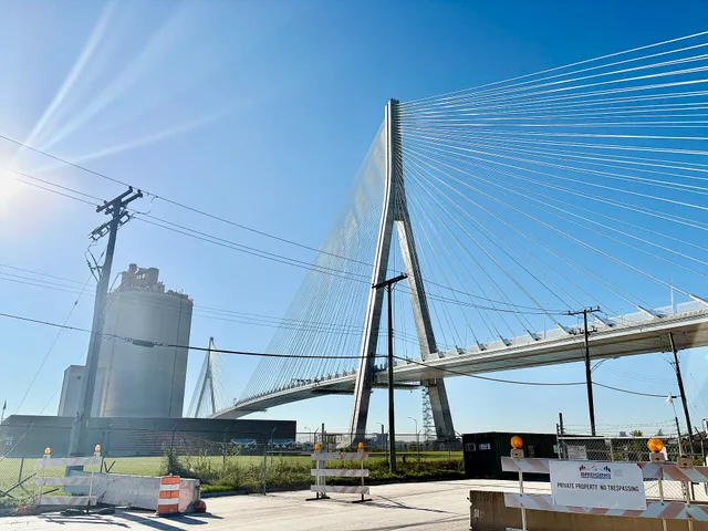
The strongest example is the Empire State Trail network in New York. Its western branch follows the Erie Canalway Trail from Albany to Buffalo. From Buffalo a signed on-road route continues north to Niagara Falls. There the Rainbow Bridge carries pedestrians and cyclists between Niagara Falls, New York, and Niagara Falls, Ontario.
This is the most practical cross-border rail-trail trip in the eastern United States. The US side is nearly all off-road, and the Canadian side connects to the Niagara River Recreation Trail.
In Michigan, the Soo Locks area is the second realistic option. The Sault Ste. Marie International Bridge links Sault Ste. Marie, Michigan, with its Ontario namesake. The bridge authority runs a shuttle for cyclists who do not want to ride the steel-deck span. From the Michigan side you can reach the bridge from the city's riverfront trail system.
In Minnesota, the border crossing at International Falls sits near the Rainy Lake area. There is no continuous rail-trail corridor to the bridge, so riders use roads for the final approach. The same is true in Washington State near Blaine, and in North Dakota and Montana, where rail trails exist but stop well south of the 49th parallel.
That geography matters when you compare corridor types. The National Park Service classifies trails by setting and use, and a rail-trail corridor behaves differently from a backcountry route. The types of trails framework is worth reading before you assume a US rail trail will behave like a Canadian rail trail at the line.
Passport and document requirements for a cross-border ride
Every cyclist entering Canada from the United States by land needs a valid passport book or passport card. A passport card is cheaper and fits a jersey pocket, and it is accepted for land and sea crossings between the US and Canada. It is not accepted for air travel.
US citizens can also use an enhanced driver's license from Michigan, Minnesota, New York, Vermont or Washington. These are state-issued IDs that prove identity and citizenship for land crossings. If you carry one, you still need a government photo ID for the return, and the same document usually works.
Lawful permanent residents of the US need their permanent resident card plus a passport from their home country. Canadian citizens entering the US by land need a valid Canadian passport. Rules for other nationalities vary, so check before booking.
Children under 16 crossing by land with a parent or guardian can use a birth certificate or other proof of citizenship. A passport is still simpler and avoids delays at a busy booth.
Carry documents in a waterproof pouch, not a seat bag that can be soaked in rain. A damaged passport can be refused. Keep a photo of your passport data page on your phone as a backup, but expect to show the physical document.
The USAGov travel resources page is the starting point for US trip planning, including what to carry and how to replace a lost passport abroad.
Before any cross-border ride, the Bureau of Land Management's Know Before You Go guidance is also useful for checking conditions, closures and local rules on the US side.
One more document matters: your bike. Some travel insurers and some border officers ask about proof of ownership. A photo of the bike with its serial number, plus the purchase receipt if you have it, avoids awkward questions about a bicycle you are bringing into Canada and back.
What customs asks when you arrive by bike
At a land port of entry, cyclists usually join the same primary inspection lane as cars. Some crossings have a separate pedestrian and bicycle lane, including the Rainbow Bridge at Niagara Falls. Where no separate lane exists, you ride to the booth, stop, and wait your turn.
Expect the standard questions. Where are you going? How long will you stay? What is the purpose of your visit? Are you carrying anything to leave behind? Do you have firearms, pepper spray, or cannabis? Answer plainly and briefly.
Remove your helmet and sunglasses before you reach the window. Officers read faces. A cyclist in a helmet and dark lenses is harder to read, and that slows the line for everyone.
Have your passport open to the photo page and hand it over with your customs declaration if one is required. Keep your hands visible. Do not take photos or video at the booth.
If you are carrying food, declare it. Canada and the US both restrict certain agricultural products, and a forgotten apple can trigger a secondary inspection. The same goes for firewood, which is restricted in many regions to slow the spread of invasive pests.
Secondary inspection is not an accusation. If you are sent inside, park the bike where directed, bring your documents and your phone, and answer the same questions again. It usually adds 20 to 60 minutes.
For the return to the US, the process repeats with US Customs and Border Protection. The US side may ask about purchases. Keep receipts for anything you bought in Canada, and know your personal exemption amount before you shop.
Route differences between US and Canadian trail segments
US rail trails and Canadian rail trails are built from the same idea, but the details differ enough to change your daily plan.
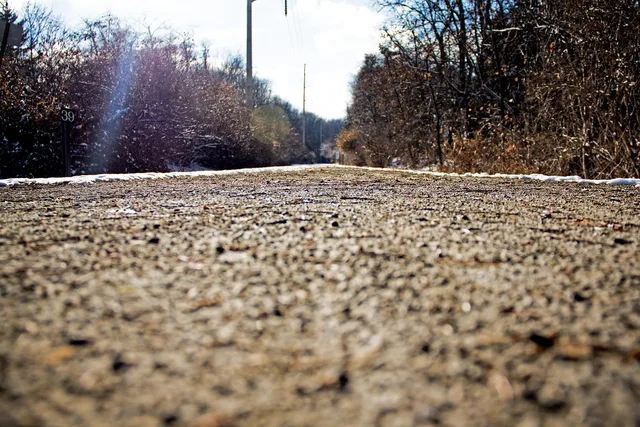
Surface is the first difference. Many US rail trails in the Northeast and Midwest are crushed limestone or packed gravel, which rolls fast when dry and slow when wet. Canadian rail trails in Ontario and Quebec are often the same, but sections near cities may be paved while rural sections can be looser, sandier or rougher.
Signage is the second. US trails usually follow a consistent wayfinding standard with mile markers and trailhead maps. Canadian trails vary by province and by municipality, and some connectors are signed only with small route decals.
Rules are the third. Some Canadian trails require a permit or a fee for certain uses, and some rail trails in Quebec are managed as linear parks with posted hours. E-bike rules also differ: Ontario and Quebec classify and restrict e-bikes differently from most US states.
Winter maintenance is the fourth. Many US rail trails are plowed or groomed in winter, but not all. Canadian segments may be groomed for snowmobiles or cross-country skiing, which changes who you share the corridor with.
Emergency services are the fifth. Cell coverage on rural Canadian segments can be sparser than on US segments, and the emergency number is 911 in both countries. Know the nearest town and the road access points before you ride a remote section.
The National Park Service explains how trails are created, which helps you understand why a US corridor ends where it does. The creation of trails overview shows how land status, easements and partners shape a route, and those same constraints explain the gaps between a US rail trail and a Canadian connection.
If you are comparing long Canadian corridors, Le P'tit Train du Nord in Quebec is a useful reference point for how a former rail line can be run as a linear park with shuttle support. It is not a border trail, but it shows the Canadian model.
Named crossings and the trail towns on each side
Two crossings carry almost all of the practical cross-border rail-trail traffic. Each has a US trail town and a Canadian trail town, and each has its own quirks.
The first is the Rainbow Bridge at Niagara Falls. On the US side, Niagara Falls, New York, is the trail town: the Empire State Trail and the Niagara River Greenway meet here, and the city has hotels, bike shops and a state park at the falls.
On the Canadian side, Niagara Falls, Ontario, connects to the Niagara River Recreation Trail, a paved route along the gorge that runs north toward Niagara-on-the-Lake and south toward Fort Erie.
Cyclists cross the Rainbow Bridge on the pedestrian walkway, which is open to bikes. There is a toll for the walkway, and it is paid on the Canadian side when you ride north. The bridge is high and exposed, so cross early in the day when wind is lighter.
The second is the Sault Ste. Marie International Bridge. On the US side, Sault Ste. Marie, Michigan, is the trail town, with the Soo Locks and a riverfront trail network. On the Canadian side, Sault Ste. Marie, Ontario, connects to the Hub Trail, a signed urban loop that links the waterfront, the canal and the city's core.
The bridge does not allow cyclists to ride across. The bridge authority runs a shuttle that carries riders and bikes, and you book it in advance. This is the crossing where a shuttle reservation is the difference between a smooth day and a wasted one.
A third crossing worth knowing is the Peace Arch at Blaine, Washington, and Surrey, British Columbia. It is a major vehicle crossing with pedestrian access, but the US rail-trail network does not reach it. Riders use roads from Bellingham or Vancouver.
A fourth is International Falls, Minnesota, and Fort Frances, Ontario. It is a quiet crossing with little cycling infrastructure on either side, and it suits riders who are comfortable on roads.
Whichever crossing you choose, treat the trail towns as part of the trip. The Kettle Valley Rail Trail article shows how much surface and shuttle detail a single corridor can require, and the same discipline applies when you plan a border crossing.
Insurance, phones and money on a two-country trip
Your US health insurance often does not cover care in Canada, and Medicare generally does not. Buy travel medical insurance that explicitly covers cycling and the countries you will visit. Read the exclusions: some policies exclude cycling entirely, and some exclude it above a certain speed or on unpaved roads.
Add evacuation coverage. A crash on a remote Canadian rail trail can mean a long transfer to a hospital, and evacuation coverage pays for that. Keep your policy number and emergency phone line on paper, not only on your phone.
For phones, check your US carrier's Canada plan before you leave. Many US plans include Canada at no extra cost, but some charge daily roaming. Download offline maps for both sides of the border, because coverage gaps happen on rural trail segments.
For money, carry a credit card with no foreign transaction fee and a small amount of Canadian cash. Many Canadian businesses take cards, but small trail-town cafes and campgrounds may be cash only. Tell your bank you are traveling so the card is not frozen.
Carry your bike repair kit and spare parts. A Canadian bike shop may not stock the same tire size or brake pads as your US shop, and a border town may have no shop at all. A simple mechanical problem can end a trip if you cannot fix it.
Most trip-ending problems are access problems, not fitness problems. The travel access failures that cut a ride short are usually a missing document, a closed connector or a shuttle that was never booked.
Planning the return leg without surprises
The return to the US is where most cross-border cyclists get caught out, because they plan the outbound crossing in detail and treat the return as automatic. It is not.
First, confirm your port of entry's hours. Not every crossing is open 24 hours, and some small crossings close overnight. Arriving at a closed port means waiting or riding to a larger one.
Second, check your documents again. A passport card works for the return by land. An enhanced driver's license works for US citizens. If your passport expires soon, renew before the trip: Canada and the US both expect validity for the duration of your stay.
Third, declare what you bought. The US has a personal exemption for returning travelers, and you need receipts. Alcohol and tobacco have separate limits. If you are unsure, declare it and let the officer decide.
Fourth, plan the US side of the return as a real riding day. After a border stop you may be tired and behind schedule, so choose a US trail town with lodging within a reasonable distance of the crossing.
Fifth, keep a buffer day. Border lines, shuttle delays and weather can each cost you half a day. A buffer turns a stressful finish into an easy one.
Use this checklist before you leave the US trailhead:
- Passport book or card, or enhanced driver's license, valid for the whole trip
- Passport card for each rider, stored in a waterproof pouch
- Travel medical and evacuation insurance that covers cycling in Canada
- Printed policy number and emergency phone line
- Offline maps for both US and Canadian segments
- Canadian cash and a no-foreign-fee credit card
- Bike serial number photo and proof of ownership
Here is a worked example. A rider leaves Buffalo, New York, on the Empire State Trail and follows the Erie Canalway west. A signed route then runs north to Niagara Falls. Day one ends in Niagara Falls, New York.
Day two starts early, crosses the Rainbow Bridge on the pedestrian walkway, pays the walkway toll on the Canadian side, and joins the Niagara River Recreation Trail for a ride to Niagara-on-the-Lake.
Day three is the return: the same bridge, a US customs declaration, receipts for any Canadian purchases, and a short US trail day back toward Buffalo. The whole loop is doable in three days, and the only fixed appointment is the bridge crossing itself.
If you are new to this kind of trip, the rail trail travel planning guide covers the basics of route, surface and logistics. The first-time visitors miss article covers the small details that catch people out, from trailhead parking to resupply gaps.