Rules
How National Park Service rules shape camping on the C&O Canal Towpath
Rail trails USA camping on the C&O Canal Towpath is free at hiker-biker sites, but NPS rules, permits, and towpath hours still shape every overnight plan.
What to take away
- Rail trails USA camping on the C&O Canal Towpath is free at designated hiker-biker sites, but National Park Service camping regulations still control where you sleep, how you reserve, and what you carry.
- Camping is allowed only in designated sitesthe free hiker-biker campsites and the drive-in and group campgrounds.
- Hiker-biker sites are first-come, first-served and free, with a limit of one night per site, per trip. Drive-in campgrounds are by reservation only.
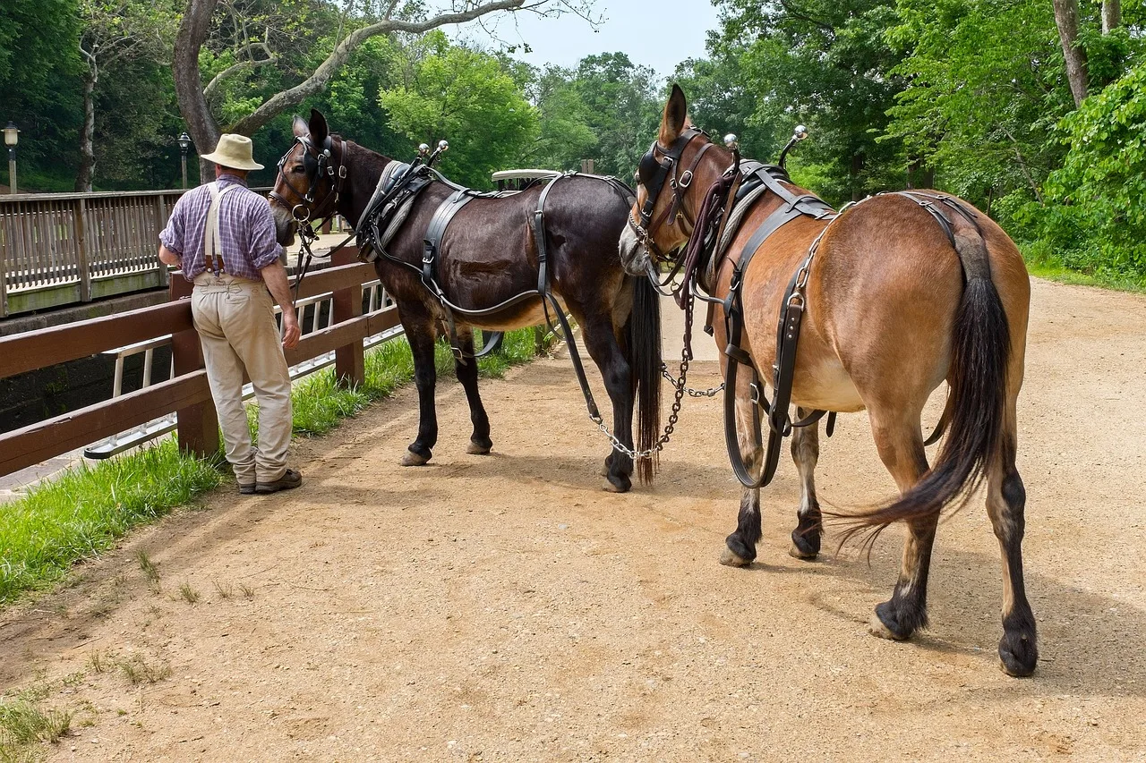
- Cyclists must yield to pedestrians and horses, ride at a safe speed, and plan around seasonal towpath closures.
- Floods, downed trees, and construction can close sections of the towpath with little notice.
How the National Park Service governs the C&O Canal Towpath
The C&O Canal Towpath is a unit of the National Park System, managed by the National Park Service as Chesapeake and Ohio Canal National Historical Park. That matters for an overnight cyclist because NPS rules, not county or state campground rules, govern where you can camp and what you can do after dark.
The park runs roughly 185 miles along the Potomac River from Washington, D.C., to Cumberland, Maryland. The towpath is a flat, dirt and gravel surface that follows the canal, open to cyclists, walkers, runners, and horseback riders. Its gentle grade makes it a common pick for accessible rail trail travel, though surfaces and campsites vary.
Because it is a national park, the usual NPS protections apply: leave no trace, stay on designated routes, and do not disturb wildlife or historic resources.
One quirk of the C&O Canal is that the park is narrow. In most places, the boundary is just the canal and a strip of land on either side. That narrow boundary is why the designated sites matter more here than in a larger park.
The legal basis is the NPS camping and food storage regulation, 36 CFR 2.10, under which the superintendent may require permits, designate sites or areas, and establish conditions for camping. At the C&O Canal those conditions are the park's posted Camping Regulations: camp only in designated sites, take all trash away (it is a trash-free park), keep quiet hours between 10 pm and 6 am, and keep pets leashed at all times.
If you are used to dispersed camping on Bureau of Land Management or U.S. Forest Service land, the C&O Canal is a different world. Here, the National Park Service camping regulations are specific and enforced.
The towpath's gentle grade and consistent surface make long days possible, but the days are still limited by water, daylight, and the spacing of the legal campsites.
You still need to plan your stops around the designated sites, and you need to know what the water at each type of site is fit for. The park's Camping pages on nps.gov are the authoritative source for locations and rules, and the site lists below follow them.
Camping rules and where they apply along the towpath
Camping on the C&O Canal Towpath is allowed only in designated sites: drive-in campgrounds, group campgrounds and hiker-biker campsites.
Drive-in campgrounds are exactly what they sound like: you can reach them by car. Every site has a chemical toilet, a picnic table, a firepit and well water, and the well water in the drive-in campgrounds is potable and treated with iodine. There are no RV hookups anywhere in the park.
Hiker-biker sites are simpler. They are spaced along the towpath specifically for people traveling by foot or bike, and every one has a chemical toilet, a picnic table, a firepit and non-potable well water. None have electricity or showers. Apart from Swains Lock at mile 16.6, they sit 1 to 5 miles from the nearest parking area.
The key rule is that you must camp in a designated site. You cannot camp on the towpath itself, on the berm between the canal and the river, or in the woods beside the trail. Rangers do patrol, and violating the camping rule can result in a citation.
The park also prohibits camping in the historic structures, such as lockhouses, unless they are specifically rented for overnight stays. Refurbished lockhouses are operated by the C&O Canal Trust; if you are looking for a base town with a bed, that is a different kind of trip.
Fires are restricted to the grills and fire rings provided, or to portable grills positioned off the ground. You should not build a new fire ring, and coals must be extinguished and removed from the park. Bring only kiln-fired or dried wood into the park; wood may also be collected from grounded dead material in the park, but it may be used in campgrounds only and must not be removed.
Pets must be leashed at all times. Hammocks are permitted at hiker-biker campsites and in the reservation campgrounds, but straps must be at least one inch wide, and zip cords, nails or screws are not allowed. Do not wash dishes, bathe or clean fish near the wells.
These rules are typical of National Park Service campgrounds, but they are worth reviewing before you go, because they are enforced.
Water is a major consideration. Since spring 2023 the well water at hiker-biker campsites has been signed non-potable: filter, chemically treat or boil it before use. Swains Lock is the exception, because it draws on municipal water. Well water is generally available from mid-April to mid-November, and the faucets are turned off for the winter, so carry a backup filter and your own supply.
The park also asks you not to tie ropes to trees and structures, so do not plan on hanging food. Store it in a sealed, solid container, especially in areas where raccoons and other animals are active, and do not leave food unattended in your tent.
Permits, fees and what you must reserve
Hiker-biker campsites on the C&O Canal are free and do not require a permit. That is one of the great attractions of the towpath for cycle tourists: you can ride up, claim a spot, and pay nothing.
The sites are first-come, first-served, so you cannot reserve a specific hiker-biker site in advance, and stays are limited to one night per site, per trip. In practice, most cyclists find space even in peak season, but on busy weekends, especially near Washington, D.C., sites can fill up.
If you are traveling in a group, you may want to arrive earlier in the afternoon.
Drive-in campgrounds are different: they are by reservation only, through Recreation.gov. The park's reservable campgrounds list for the C&O Canal names five: Antietam Creek (mile 69.4), McCoys Ferry (mile 110.4), Fifteenmile Creek (mile 140), Paw Paw Tunnel (mile 156.1) and Spring Gap (mile 173.3). Group campsites at Marsden Tract (mile 11.5), McCoys Ferry, Fifteenmile Creek and Spring Gap cost $40 per site per night during peak season and $20 during non-peak season. Stays are limited to 14 days between May 1 and October 1, and to 30 days in the calendar year.
Reservations are made on Recreation.gov, and the listing shows the nightly fee for a single drive-in site before you book. The limit is eight people per drive-in site.
There is no general towpath permit for cycling. You do not need a permit to ride the towpath or to camp at hiker-biker sites.
Group size is the main trigger. Groups with more than eight people need to use the group campsites or register for more than one site in a campground. Large group events and commercial trips go through the park's Permits Office.
For individual cyclists, the main requirement is to follow the rules and to pay any fees at drive-in campgrounds. Overnight parking is allowed in designated parking areas without a permit.
If you are planning a longer trip that combines the C&O Canal with other trails, such as the Great Allegheny Passage rail trail that continues from Cumberland, you may need to think about permits or fees on those other trails. The C&O Canal itself is straightforward.
The park's Frequently Asked Questions page on nps.gov addresses common questions about permits and fees, and it is a good place to confirm details.
Hiker-biker sites and their spacing
Hiker-biker sites are the backbone of a towpath overnight trip. The gaps between them are not even, so match each day's ride to the actual site list rather than an average.
That means you can plan a daily mileage that suits you, whether you want a short day or a long one. The sites are named, and many are associated with nearby locks or landmarks.
The park publishes the full list, with a mile marker for every hiker-biker campsite, and it covers the whole towpath.
What the official list shows / Detail
- Site names
- Named for the nearest lock, creek, or landmark, east to west
- Mile markers
- From Swains Lock at mile 16.6 west to the sites near Cumberland
- Water
- A hand pump at many sites, seasonal in winter
- Toilet
- A chemical toilet, listed for every site
- Spacing
- Roughly every 5 to 7 miles, uneven in places
- Where to find it
- The park's camping page, linked earlier in this article
The park's list of hiker-biker campsites, east to west:
- Montgomery County, MDSwains Lock (mile 16.6), Horsepen Branch (mile 26.1), Chisel Branch (mile 30.5), Turtle Run (mile 34.4), Marble Quarry (mile 38.2).
- Frederick County, MDIndian Flats (mile 42.5), Calico Rocks (mile 47.6), Bald Eagle Island (mile 50.3).
- Washington County, MDHuckleberry Hill (mile 62.9), Killiansburg Cave (mile 75.2), Horseshoe Bend (mile 79.2), Big Woods (mile 82.7), Opequon Junction (mile 90.9), Cumberland Valley (mile 95.2), Jordan Junction (mile 101.2), North Mountain (mile 110), Licking Creek (mile 116), Little Pool (mile 120.6), White Rock (mile 126.4), Leopards Mill (mile 129.9), Cacapon Junction (mile 133.6).
- Allegany County, MDIndigo Neck (mile 139.2), Devils Alley (mile 144.5), Stickpile Hill (mile 149.4), Sorrel Ridge (mile 154.1), Purslane Run (mile 156.9), Town Creek (mile 162.1), Potomac Forks (mile 164.8), Pigmans Ferry (mile 169.1), Irons Mountain (mile 175.3), Evitts Creek (mile 180.1).
Use the park's list to plan your stops, because some sites may be closed for maintenance or seasonal reasons. The longest gaps, of more than twelve miles each, run from Bald Eagle Island to Huckleberry Hill and on to Killiansburg Cave.
The list follows a pattern: sites are frequent, they have basic amenities, and they are spaced so that a typical cyclist can cover 30 to 50 miles a day.
When you arrive at a hiker-biker site, you will find a clearing with a picnic table, a firepit, and a chemical toilet. Each site holds five to ten tents, depending on the campsite, and signage at the site gives the details. The well water is non-potable and must be treated, and it is turned off from mid-November to mid-April.
You should not count on water being available at every site, so carry more than you think you need, especially in summer.
The sites are shared, so you may be camping with other cyclists. Be considerate: keep noise down after dark, and do not monopolize the picnic table.
If you are looking for a two-day trip, you can use these sites to break the ride into manageable chunks. For a detailed example, see two-day rail trail itinerary, which shows how to link access points and town stops.
The key is to match your daily mileage to the site spacing and to have a backup plan if a site is full or closed.
Cycling rules and hours that affect a camping plan
The towpath is open to cyclists year-round, but there are rules. Cyclists must yield to pedestrians and to horses.
That means you should slow down, ring a bell or call out, and pass on the left when it is safe.
The towpath is not a race course; speed limits are not posted everywhere, but you are expected to ride at a safe speed for conditions. In busy areas near Washington, D.C., you may need to slow to a walking pace when passing others.
Hours matter for camping. The towpath itself is open 24 hours a day in most sections, but some areas, such as the Georgetown section in Washington, D.C., may have different hours.
More importantly, you should not arrive at a hiker-biker site in the middle of the night and expect to find a spot. Plan to arrive before dark, both for safety and for courtesy, and respect the 10 pm quiet hours.
The park also has rules about riding after dark: you need a white light on the front and a red reflector or light on the rear. A headlamp is not enough by itself, though it helps.
E-bikes are allowed on the towpath if they meet the park's definition of an electric bicycle. That generally means a bike with pedals and a motor that assists only when you pedal, with a top assisted speed of 20 mph. Throttle-only e-bikes may not be allowed.
Check the park's Biking page on nps.gov for the current policy, because it can change.
In wet conditions, the towpath can be muddy and soft. Riding on a soft towpath causes ruts and damage, and the park may close sections to protect the surface. The Paw Paw Tunnel, near mile 155, is one example: repair work there has closed the towpath, and the detour climbs over the tunnel hill.
If you are planning a trip in spring, you should check for closures related to drainage and mud season. The park posts alerts on its website and sometimes on social media.
A closure can add many miles to your day if you have to detour on roads, so always have a backup plan.
Safety and conditions checks before a towpath overnight
Before you leave for a towpath overnight, check the park's current conditions and safety pages on nps.gov. The park posts alerts about closures, hazards, and other important information.
The alerts cover topics such as flooding, downed trees, and construction. Because the towpath runs along a river, it is prone to flooding after heavy rain.
Do not ride through floodwater; it can be deeper and faster than it looks, and the towpath surface may be washed out underneath.
Cell service is spotty along much of the towpath, especially in the western sections. Do not rely on your phone for navigation or emergencies.
Carry a paper map or a downloaded offline map, and tell someone your plans. The park recommends that you carry a first aid kit, plenty of water, and tools to fix a flat tire.
In summer, heat and humidity can be severe, and there is little shade in some sections. In winter, ice and snow can make the towpath impassable.
Here is a checklist to run through before you go:
- Note the mile marker of each planned stop and the nearest road access.
- Confirm that your planned hiker-biker sites are open and that the well water is on (mid-April to mid-November).
- Carry at least two liters of water per person, more in hot weather, and a filter or treatment for well water.
- Pack a basic repair kit, including a spare tube, pump, and multi-tool.
- Bring a front white light and a rear red light or reflector for dusk riding.
- Store food securely in a sealed container and never leave it in your tent.
- Tell someone your route and expected arrival times.
Beyond the official checks, think about your own comfort and safety. If you are new to bike camping, you might be surprised by how much time you spend setting up and breaking camp.
The first-time visitors miss article covers common oversights, such as underestimating the towpath's rough surface or forgetting that water pumps may be dry.
Finally, respect the park and other visitors. The C&O Canal is a national treasure, and its rules exist to protect it. If you follow the National Park Service camping regulations, you will have a smoother trip and help keep the towpath open for everyone.