Features
Comparing mud season and heat windows on the Katy Trail and Great Allegheny Passage
Rail trails USA: compare mud season and heat windows on the Katy Trail in Missouri and the Great Allegheny Passage in Pennsylvania and Maryland, month by month.
What to take away
- For rail trails USA, the Katy Trail in Missouri and the Great Allegheny Passage in Pennsylvania and Maryland have opposite mud and heat calendars.
- On the Katy Trail, mud peaks from late February through April; the heat window runs from June through August.
- On the Great Allegheny Passage, freeze-thaw mud is worst in March and early April; the heat window is July through early September.
- Check current conditions before you committhe Katy Trail has no single live conditions page, while the Great Allegheny Passage relies on the Chesapeake & Ohio Canal National Historical Park for its eastern end.
- May and October are the safest months for a long ride on either corridor.
Two corridors, two very different weather calendars
The Katy Trail in Missouri runs about 240 miles across the state on a former Missouri-Kansas-Texas Railroad line. Most of it is crushed limestone. The trail follows the Missouri River from near St. Charles to Clinton, with a spur to Sedalia. Because it sits in the river valley, it drains slowly after rain and holds moisture in spring.
Katy Trail vs Great Allegheny Passage
Katy Trail
- Length
- 240 miles
- Surface
- Crushed limestone
- Route
- Missouri River valley
- Climate
- Continental, humid
- Spring
- Short, muddy
- Summer
- Hot, humid
Great Allegheny Passage
- Length
- 150 miles
- Surface
- Limestone and asphalt
- Route
- Allegheny Mountains
- Climate
- Mountain, colder
- Spring
- Later, freeze-thaw
- Summer
- Cooler, shaded
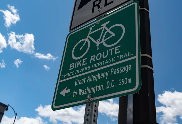
The Great Allegheny Passage in Pennsylvania and Maryland runs about 150 miles from Pittsburgh to Cumberland, Maryland. It is crushed limestone and asphalt. It climbs through the Allegheny Mountains and crosses the Eastern Continental Divide. Its eastern end connects to the Chesapeake & Ohio Canal towpath, which continues to Washington, D.C.
Both are rail trails, but their weather calendars barely overlap. The Katy Trail has a continental climate with hot, humid summers and short, muddy springs. The Great Allegheny Passage has a mountain climate with colder winters, later springs and cooler summers.
That difference matters for trip timing. A week that is perfect on one corridor can be miserable on the other. This guide compares mud season and heat windows month by month, so you can pick the right window for the right trail.
If you are building a trip around town stops, start with when should bike itinerary building actually start in 2027.
Mud season on the Katy Trail in Missouri
Mud season on the Katy Trail is a spring problem, not a winter one. The trail surface is crushed limestone over clay. When the clay saturates, the limestone turns into a greasy paste that packs into tires and drivetrain. Riding it in that state damages the trail and your bike.
The Missouri Department of Natural Resources, which manages the Katy Trail, does not publish a single live mud report. Instead, mud season is predictable by month. Late February through April is the wettest stretch. March is usually the worst single month.
Here is month-by-month mud guidance for the Katy Trail.
Mud season on the Katy Trail
| Month | Katy Trail mud risk | Typical rainfall | Notes |
|---|---|---|---|
| January | Low | 2.0 in | Frozen ground, some freeze-thaw |
| February | Moderate | 2.2 in | Late month mud starts |
| March | High | 3.5 in | Worst mud month |
| April | Moderate to high | 3.8 in | Dries by late month |
| May | Low | 4.5 in | Firm trails, normal rain risk |
| June | Low | 4.2 in | Firm, watch heat |
| July | Low | 3.8 in | Firm, watch heat |
| August | Low | 3.5 in | Firm, watch heat |
| September | Low | 3.5 in | Firm |
| October | Low | 3.0 in | Firm |
| November | Low | 3.0 in | Firm |
| December | Low | 2.5 in | Frozen, some freeze-thaw |
Katy Trail Mud Season by Month
- JanuaryFrozen or firm, some ice
- FebruaryLate-month thaw, mud west
- MarchPeak mud, riders avoid
- AprilMud early, dries late
- MayDry, brief soft spots
- June-SeptemberDry except thunderstorms
- October-DecemberFirm and fast
The Katy Trail's mud season is shorter than many riders expect. It is intense but concentrated. If you can wait until May, you skip it entirely.
Mud is worst between St. Charles (mile 28) and Jefferson City (mile 148), with Hartsburg (mile 153) and Rocheport (mile 170) also soft in March.
For a deeper look at how drainage shapes trail town visits, see drainage and mud season.
Mud and freeze-thaw on the Great Allegheny Passage
The Great Allegheny Passage has a different mud problem. Its surface is crushed limestone, but its climate is colder. Mud season here is driven by freeze-thaw cycles, not just rain.
In late winter and early spring, the trail surface thaws during the day and refreezes at night. That cycle breaks down the limestone and creates soft, rutted sections. The worst stretch is usually March through early April. The higher elevations near the Eastern Continental Divide hold frost longer.
Here is month-by-month mud guidance for the Great Allegheny Passage.
Mud and freeze-thaw on the GAP
| Month | GAP mud risk | Typical freeze-thaw days | Notes |
|---|---|---|---|
| January | Low | 15 | Frozen, snow possible |
| February | Moderate | 12 | Late month thaw starts |
| March | High | 20 | Worst freeze-thaw mud |
| April | Moderate to high | 10 | Early month mud, dries late |
| May | Low | 2 | Firm trails |
| June | Low | 0 | Firm |
| July | Low | 0 | Firm, watch heat |
| August | Low | 0 | Firm, watch heat |
| September | Low | 0 | Firm |
| October | Low | 1 | Firm |
| November | Low | 5 | Firm, frost starts |
| December | Low | 12 | Frozen, some freeze-thaw |
GAP Mud and Freeze-Thaw by Month
- JanuaryFrozen, ice in shaded cuts
- FebruaryFreeze-thaw begins
- MarchPeak freeze-thaw mud
- AprilMud early, lower areas dry
- MayMostly dry
- June-SeptemberDry, afternoon storms
- October-DecemberFirm, then frozen
The Great Allegheny Passage also has a specific closure issue: the Big Savage Tunnel, near the divide, closes seasonally. It typically closes in late fall and reopens in spring. Check the trail's official site or the National Park Service before you plan a winter or early spring ride.
Freeze-thaw mud is worst from Rockwood (mile 89) to Meyersdale (mile 109) and on to the Eastern Continental Divide (around mile 125). The Big Savage Tunnel (around mile 130) closes seasonally.
For current conditions at the eastern end, the Chesapeake & Ohio Canal National Historical Park publishes Current Park Conditions - Chesapeake & Ohio Canal National Historical Park (U.S. National Park Service). That page covers mud, closures and towpath status.
Heat windows month by month on both corridors
The heat window is the opposite problem. On both corridors, summer heat can be dangerous. But the timing and intensity differ.
Heat Risk Month by Month
Katy Trail
- May
- Low
- June
- Moderate to high
- July
- High
- August
- High
- September
- Moderate
- October
- Low
Great Allegheny Passage
- May
- Low
- June
- Low to moderate
- July
- Moderate to high
- August
- High
- September
- Moderate
- October
- Low
On the Katy Trail in Missouri, the heat window runs from June through August. July is typically the hottest month, with average highs around 88°F and heat index values often exceeding 100°F. Humidity is high, and the river valley traps heat. The trail has limited shade in some sections, especially west of Jefferson City.
On the Great Allegheny Passage, the heat window is shorter and milder. It runs from July through early September. August is usually the hottest month, with average highs around 81°F and heat index values near 85°F. Because the trail is in the mountains and often shaded, extreme heat is less common.
But humidity can still be high, and the climb to the divide generates its own heat.
Here is a month-by-month heat comparison.
Heat windows month by month
Katy Trail heat risk
- May
- Low
- June
- Moderate to high
- July
- High
- August
- High
- September
- Moderate
- October
- Low
Katy Trail typical high / heat index
- May
- 75°F / 75°F
- June
- 84°F / 90°F
- July
- 88°F / 100°F
- August
- 87°F / 100°F
- September
- 80°F / 82°F
- October
- 70°F / 70°F
Great Allegheny Passage heat risk
- May
- Low
- June
- Low to moderate
- July
- Moderate to high
- August
- High
- September
- Moderate
- October
- Low
Great Allegheny Passage typical high / heat index
- May
- 68°F / 68°F
- June
- 78°F / 80°F
- July
- 82°F / 85°F
- August
- 81°F / 84°F
- September
- 74°F / 75°F
- October
- 63°F / 63°F
For both trails, the safest strategy is to ride early in the day. Start at dawn. Finish by early afternoon. Carry more water than you think you need.
The Occupational Safety and Health Administration publishes Heat - Overview: Working in Outdoor and Indoor Heat Environments | Occupational Safety and Health Administration guidance that applies to cyclists as outdoor workers in the heat. It covers hydration, rest breaks and heat illness warning signs.
For gear that matches the season, see dog-friendly rail trails lodging.
Reading current conditions before you commit
Neither trail has a single official live conditions page for its entire length. You have to check multiple sources.
Before You Commit: Conditions Check
- Check official trail website for alerts
- Check local trail group social media
- Check weather forecast for ride week
- Check tunnel and facility seasonal hours
For the Katy Trail in Missouri, the Missouri Department of Natural Resources posts alerts on its website. Local trail groups and Facebook pages often report mud and closures faster. For the Great Allegheny Passage, the Allegheny Trail Alliance and local trail councils post updates. The Chesapeake & Ohio Canal National Historical Park covers the eastern connection.
For weather guidance relevant to heat and mud season planning, the National Park Service publishes Weather - Chesapeake & Ohio Canal National Historical Park (U.S. National Park Service). It covers seasonal patterns and what to expect.
For operating hours and seasons relevant to heat windows and trip timing, see Operating Hours & Seasons - Chesapeake & Ohio Canal National Historical Park (U.S. National Park Service). The towpath is generally open year-round, but some facilities and tunnels have seasonal hours.
Here is a current conditions checklist before you commit.
- Check the official trail website for alerts and closures.
- Check local trail group social media for recent mud or debris reports.
- Check the weather forecast for the week of your ride, not just the day.
- Check tunnel and bridge status, especially on the Great Allegheny Passage.
- Check water availability in towns along your route.
- Check for any special events that might affect access.
If you are new to long rail trails, read first-time visitors miss about what first-time visitors miss.
Choosing your month for a rail trails USA trip
If you want one month that works for both corridors, choose May or October. May has firm trails, mild temperatures and long daylight. October has dry surfaces, cool air and fall colors. Both months avoid mud season and the worst heat.
Which Trail, Which Month
Want one month for both?
Choose May or October
Match trail to season
If you must ride in summer, choose the Great Allegheny Passage over the Katy Trail. The mountains are cooler and shadier. If you must ride in early spring, choose the Katy Trail over the Great Allegheny Passage. The Katy Trail dries earlier and has less freeze-thaw.
Here is a simple month-by-month recommendation for a rail trails USA trip.
Choosing your month
- JanuaryGreat Allegheny Passage for fat biking, Katy Trail for a short frozen ride if the ground is hard.
- FebruaryKaty Trail in the west, Great Allegheny Passage in the east; expect late-month thaw.
- Marchavoid both; if you must, ride the Katy Trail west of Jefferson City where it dries first.
- AprilKaty Trail late month, Great Allegheny Passage late month; early April still has freeze-thaw mud on the GAP.
- Mayboth corridors are excellent; firm trails and mild temperatures.
- JuneGreat Allegheny Passage early, Katy Trail early morning only; heat builds on the Katy.
- JulyGreat Allegheny Passage, because mountain shade and cooler highs beat the Katy's heat index.
- AugustGreat Allegheny Passage, but start at dawn; the GAP is still the cooler choice.
- Septemberboth corridors work; the Katy cools first while the GAP stays mild.
- Octoberboth corridors are excellent; dry surfaces and fall colors.
- NovemberKaty Trail early month, Great Allegheny Passage early month; frost returns late.
- DecemberKaty Trail for a short frozen ride, Great Allegheny Passage for fat biking if snow allows.
For a sample route that works in shoulder seasons, see two-day rail trail itinerary ideas for a two-day rail trail itinerary.
Common questions
When is mud season on the Katy Trail?
Mud season on the Katy Trail runs from late February through April, with March usually the worst month. The trail is typically firm by early May.
When is mud season on the Great Allegheny Passage?
Mud season on the Great Allegheny Passage runs from late February through early April, driven by freeze-thaw cycles. Higher elevations stay muddy longer.
What is the heat window on the Katy Trail?
The heat window on the Katy Trail is June through August, with July typically the hottest and most humid month. Ride early in the day to avoid the worst heat.
What is the heat window on the Great Allegheny Passage?
The heat window on the Great Allegheny Passage is July through early September, with August usually the hottest month. Mountain shade helps, but humidity can still be high.
Where can I check current conditions for both trails?
For the Great Allegheny Passage and its eastern connection, check the Chesapeake & Ohio Canal National Historical Park conditions page. For the Katy Trail, check the Missouri Department of Natural Resources and local trail groups.
Which month is best for a rail trails USA trip on either corridor?
May and October are the best months for both corridors. They avoid mud season and the worst heat, and the trails are typically firm and fast.